Posts

DETERMINE WHICH WEB LAYERS TO SHARE FROM ARCGIS PRO

Image
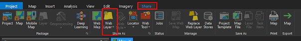
Web layers that can be shared from ArcGIS Pro. There are seven web layers types that can be shared from ArcGIS Pro: Feature, Tile, Vector Tile, Map image, imagery, scene, and elevation. Feature, tile ,vector tile, map image and imagery layers share 2D data, while scene and elevation layer share 3D data. When you share a web layer, a service is published and exposed through the web layer. Depending on the layer type and how it is configured, an ArcGIS Server service or a hosted service is published. Required Privileges. To share any content from ArcGIS Pro, you must have an account that is part of ArcGIS organization that has privileges to create, update and delete content. The sharing of web layers require additional privileges that vary depending on the layer type and how it's configured.If an ArcGIS Server service will be published, the privilege to publish a server-based is required. Determine the layer type to share. A number of factors should be considered when determining the

15 Easy Steps For Auto Georeference A Raster Dataset In ArcGIS Pro

Image
What is Georefrencing Georeferencing means that the internal coordinate system of a digital map or aerial photo can be related to a ground system of geographic coordinates. A georeferenced digital map or image has been tied to a known Earth coordinate system, so users can determine where every point on the map or aerial photo is located on the Earth's surface.   Georefrencing In ArcGIS Pro In ArcGIS Pro we use georefrencing tools to georefrence the raster datasets. The georefrence tab contains all the tools you need to georefernce your raster datasets. In this blog we discuss only about Auto georeferncing a raster dataset in ArcGIS Pro. The Auto Georefrencing functionality allows us to automatically georefrence raster datasets to the refrenced raster datasets. The automated control points are based on the spectral signature of different locations across your image.  Note: Auto Georefrencing function does not work well with scanned maps, historical data or elevation data. For Auto G